Hi! Here comes some interesting (hopefully) notes about what it is that we’re doing onboard R/V Skagerak all day long.
We are going up and down the Koster Trench, mainly because we want to know how the deep water is being exchanged in the trench. If we know how the water masses are flowing and what they contain we can use that information to estimate how, for example, trawlers affect the waters in their surroundings. Trawlers cause a lot of turbidity due to the way they fish. The turbidity is a way to estimate how many particles there are in the water: how ”cloudy” it is. Since trawling is done at the bottom of the ocean, a lot of sediment particles are being suspended into the water column and transported to other places where it falls down again and becomes sediment.
According to some studies, increased sedimentation makes it harder for life to survive, which is especially bad since there is a Marine National park (the first in Sweden) located nearby. It is The Koster Marine National Park which is also a Natura 2000 protected area. This gives the marine park protection by European law from activities outside and inside the area that might harm the threatened habitats and species inside it. One example of the unique marine life there is the beautiful cold water coral Lophelia which has it’s only habitat in Sweden inside the borders of the park.
Another possible threat might be the enlargement of the harbour at the Norwegian town of Fredrikstad, which is connected to the Koster Trench. The dredging that has to be done in order to make the harbour larger might affect the surrounding waters in ways that we don’t fully understand, since not many studies have been done on how the water (and in turn the particles suspended in the water) flows around there.
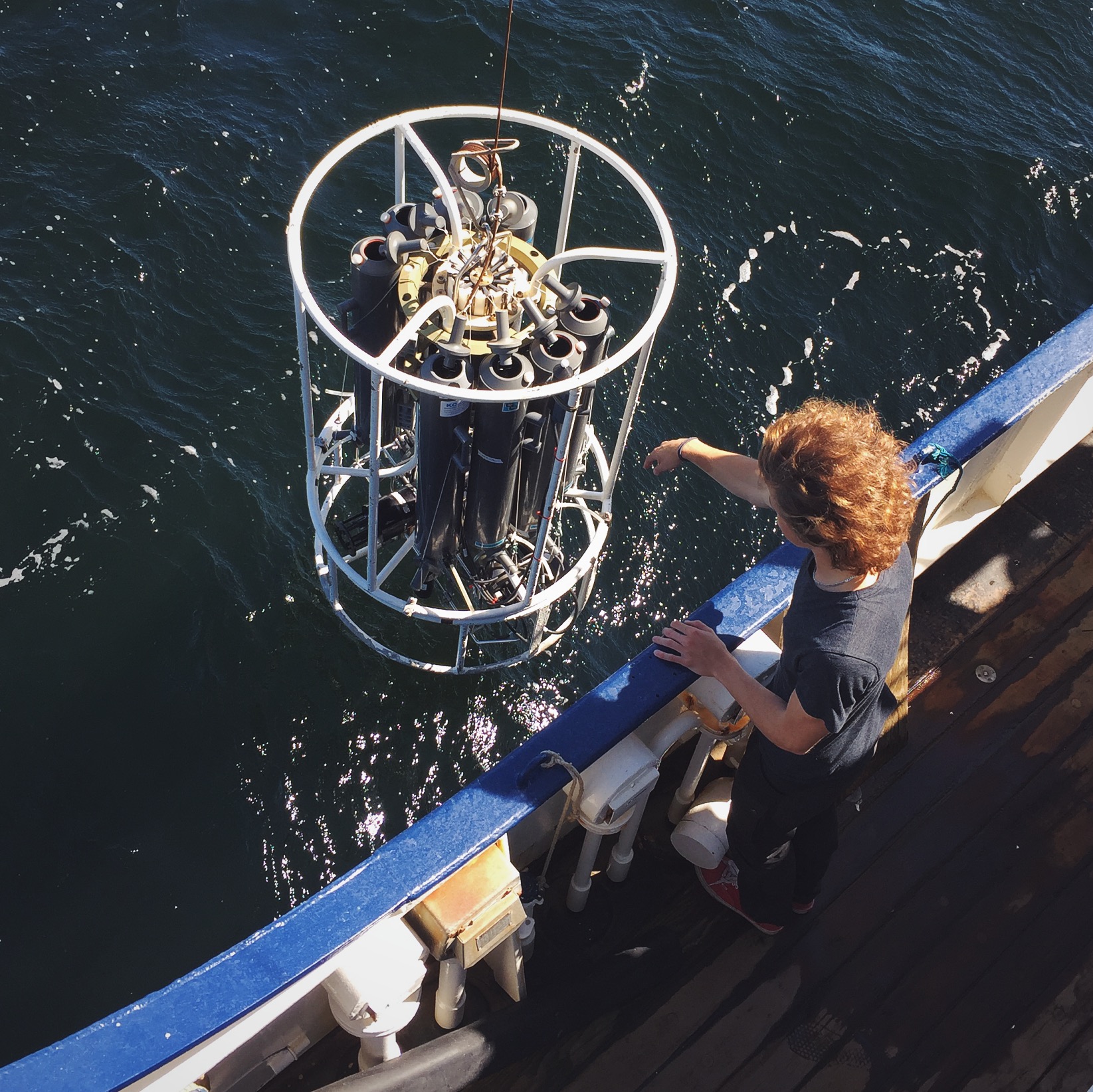
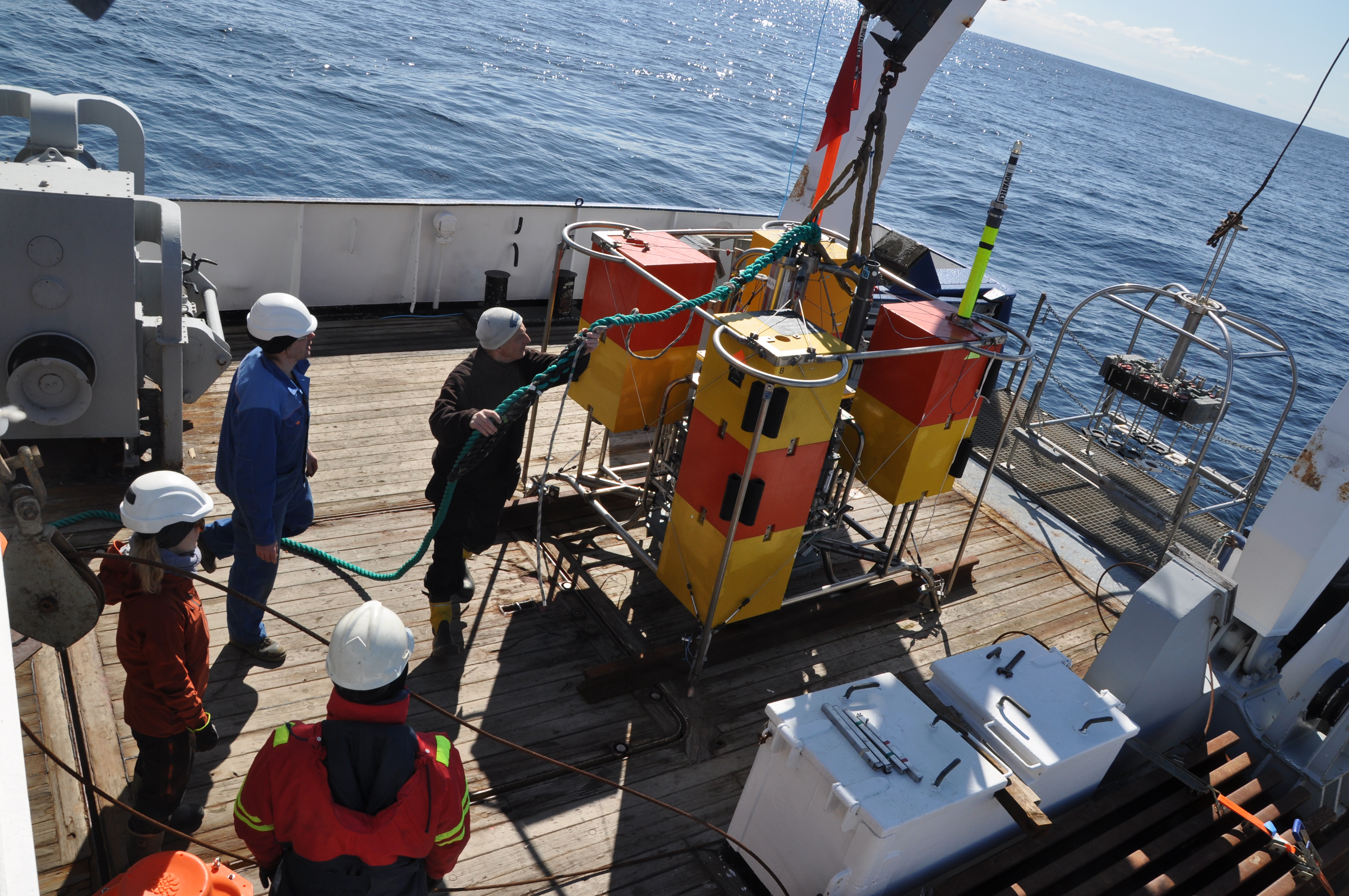
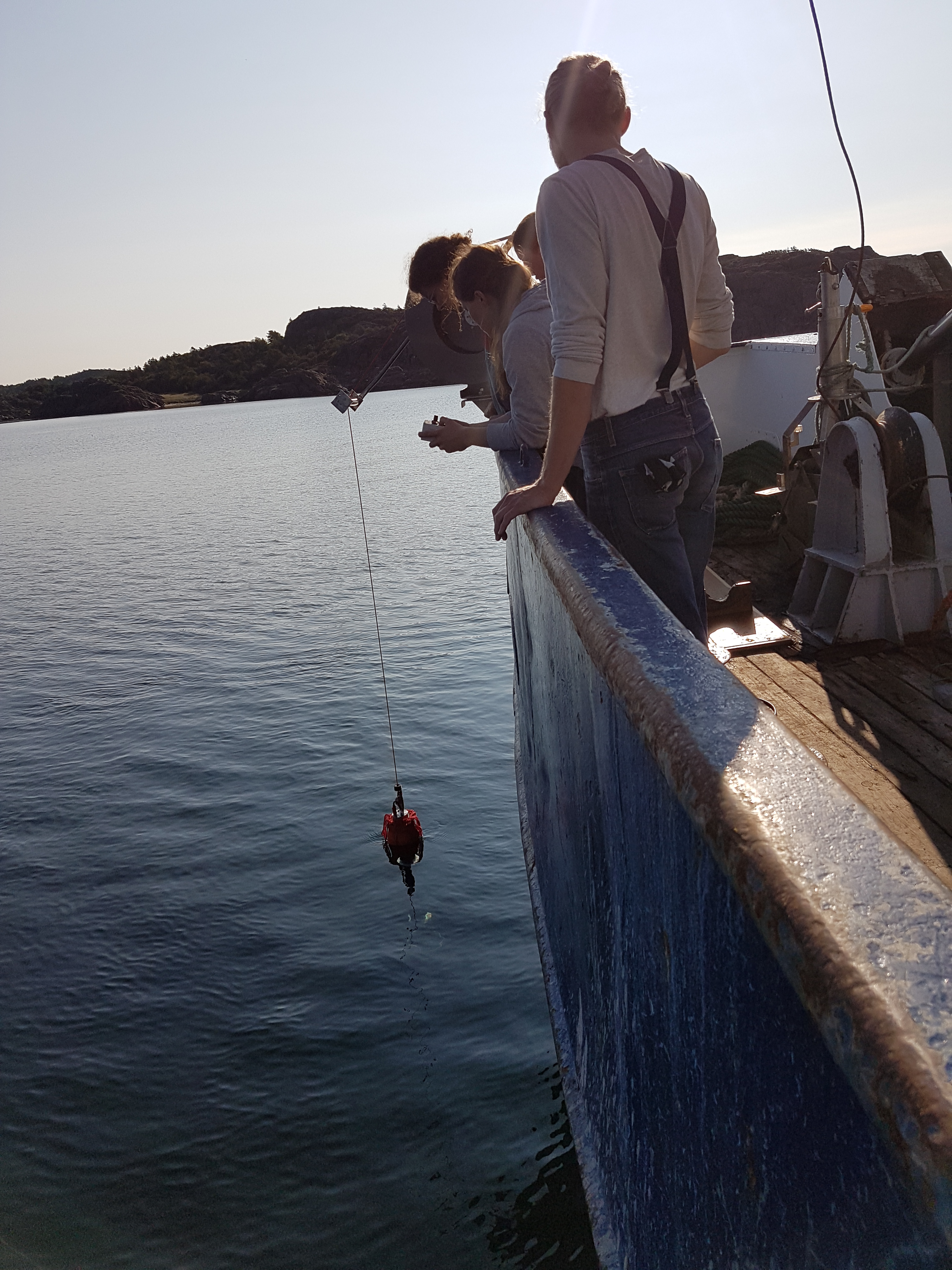
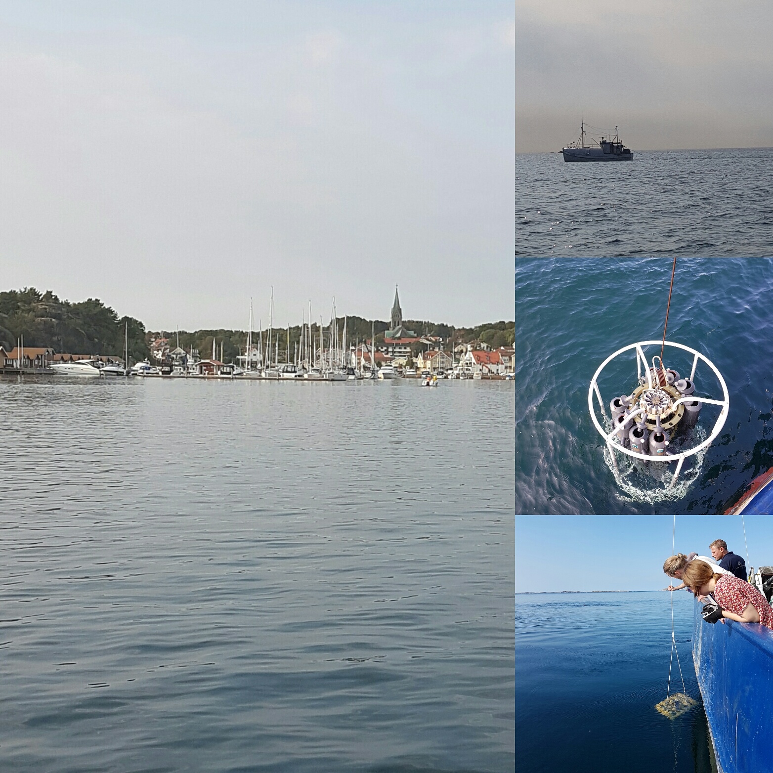
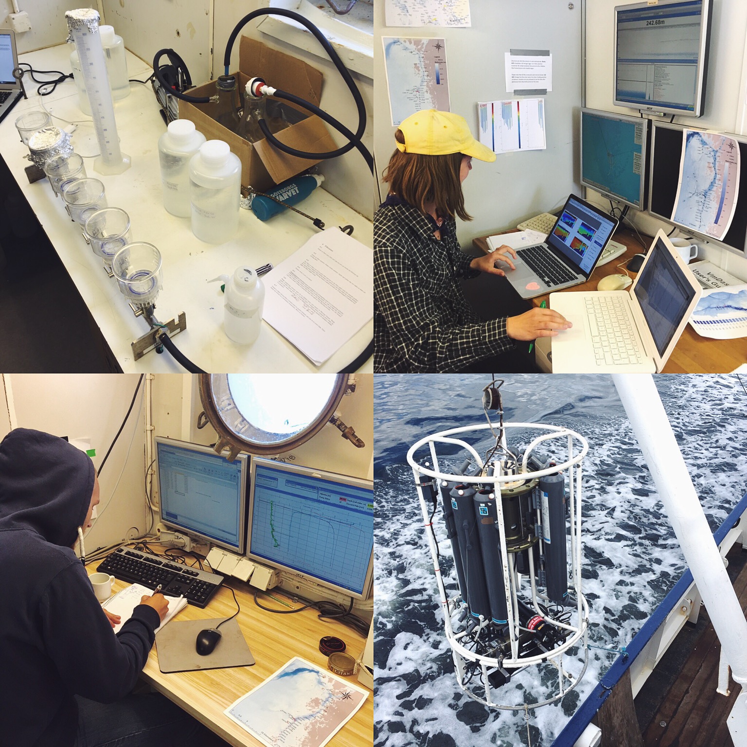
The main instrument we use is the CTD which stands for Conductivity (which is a way to estimate salinity), Temperature and Depth, and that is also what it measures, among other things. The CTD is mounted on the white steel frame that you can see on the picture above. There are also 8 Niskin bottles that are used to sample waters at different depths. We also have another device mounted on the frame, it’s called the LISST and it measures particles and their size with laser diffraction technology. The frame is lowered to the bottom of the ocean and as it goes down (and up) the different devices are continuously collecting data.
From the Niskin bottles (named after an American inventor) we collect water samples that are taken to the filtration laboratory (seen in the first picture) where we filter the water and collect the particles on filters that are being frozen. Later they will be taken to another lab and weighted then burnt and weighted again. That is done to determine how much of the particles in the water (that are measured by the LISST) that are of biologic origin and how much that isn’t.
I guess that’s quite much to process, that’s why the post for tomorrow will be a bit less science related, and we promise there will be cute animals!
For a short movie of me collecting a water sample and other pictures from this expedition, visit our Instagram; marinvetenskapgu.
See you in another post!